Garden of Eden location Map – Can the Garden of Eden be located on a map? | Gleason L. Archer
Can the Garden of Eden be located on a map? Garden of Eden location Map
Garden of Eden location Map – Can the Garden of Eden be located on a map? | Gleason L. Archer
المحتوى
Toggle
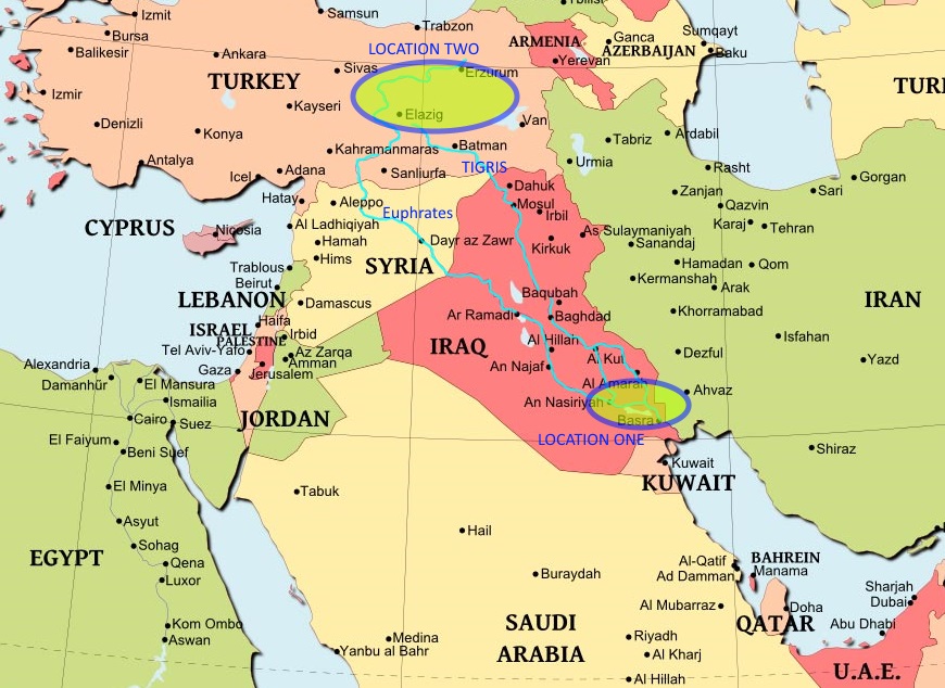
Genesis 2:10–14 furnishes some clues to the general location of Eden, but it presupposes geological conditions that no longer hold. Hence it is hazardous to conjecture any site more precise than the headwaters of the Tigris and Euphrates rivers in the highlands of Armenia (i.e., the eastern border of modern Turkey).
The large river flowing from Eden subdivided into the Tigris and the Euphrates, as well as into two other long rivers (the Pishon, leading down to Havilah, along the southern coast of Arabia, and the Gihon, which went over to Cush—which may have been some Asiatic region lying to the east rather than the African Cush that was Ethiopia).
This indicates that the site was a high plateau or mountainous region (insuring a cool and comfortable temperature for Eden during the summer season), having copious headwaters to supply the four major river systems this passage describes. The Havilah, through which the Pishon flowed, was rich in gold, spices, and deposits of precious stones—which were found in abundance along the southern or southwestern coasts of Arabia.
For the Cush, no such helpful clues are given; the name has been connected by some scholars with Kish in Sumeria or with the Kassites (who are thought to have originated in the Zagros mountain region).
The most plausible explanation for the later complete disappearance of the Pishon and Gihon rivers is the theory that mountain-building activity accompanying continental drift (for Arabia was originally connected with the Somalian and Ethiopian coast during prehistoric times) may have terminated those two river systems in the antediluvian period. This would be analogous to the uplift of the Mount Seir Range in Edom, which prevented the Jordan River from flowing all the way down to the Gulf of Aqaba, as it originally did.[1]
[1]Archer, G. L. (1982). New International Encyclopedia of Bible Difficulties. Originally published: Encyclopedia of Bible difficulties. 1982. Zondervan’s Understand the Bible Reference Series (69). Grand Rapids, MI: Zondervan Publishing House.


